Is the USDA Hardiness Zone Map Accurate for Microclimates in Your City or Backyard
Nov 21, 2025

The USDA hardiness zone map is a widely used reference for gardeners to understand which plants can survive in their region. It gives an idea of the average minimum winter temperatures and helps you decide what to plant. But many gardeners find that the map does not always match what actually happens in their backyard. This is because every city and even every neighborhood can have microclimates that differ from the broader zone.
In this article, we are going to look at how accurate the map is for your exact location and explore the reasons why your yard might behave differently. We will also look at some ways to check your own microclimate so you can choose plants with better confidence.
What the USDA Hardiness Zone Map Actually Shows
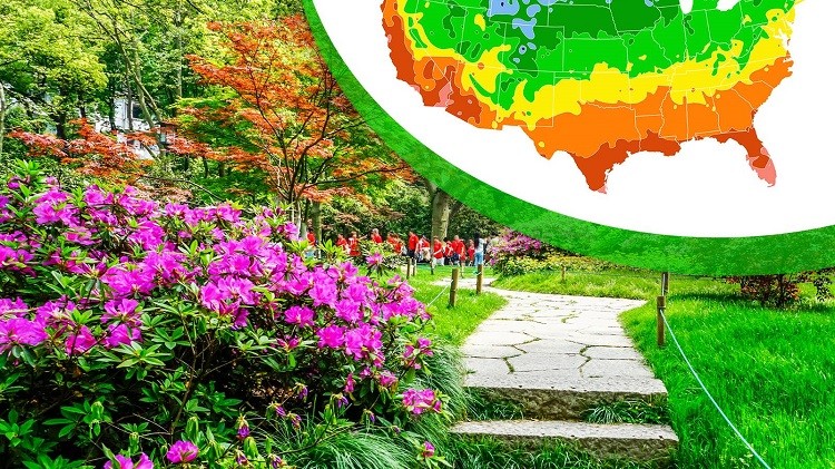
The USDA hardiness zone map is based on long-term temperature data collected across the country. Each zone represents a range of minimum temperatures that plants are expected to tolerate. For example, if your area is listed as Zone 7, it means your lowest winter temperature usually falls within that zone range.
This information is helpful for broad planning. It gives you a starting point for plant selection. But the map covers large regions and does not account for local variations that can affect plant survival.
Why Microclimates Cause Differences
Microclimates form due to small environmental factors that change the temperature or moisture around a particular spot. These differences are very common and can influence plant growth significantly.
Urban Heat
In cities, concrete, asphalt, and buildings trap heat. This can cause an area to stay warmer during winter nights. As a result, your property may act like a warmer zone compared to the official map.
Elevation
Even a small change in elevation can influence temperature. Higher areas may cool faster, while lower areas can trap cold air. Because of this, homes on hillsides or valleys may experience colder or warmer conditions than the zone listed for the region.
Wind Exposure
Some neighborhoods face strong winds, while others are sheltered by trees or buildings. Wind can lower the temperature around plants and make them more vulnerable during winter.
Shade Levels
The amount of sunlight your yard receives plays a major role. Shaded yards can stay cooler and hold moisture longer. Sun-exposed areas warm up faster and stay warmer during the day.
Bodies of Water
If your home is close to a lake, pond, or river, you may experience more moderate temperatures. Water releases heat slowly, which helps keep the nearby area warmer during cold nights.
These factors contribute to temperature changes that the USDA hardiness zone map cannot show for every home or garden.
How to Check If Your Microclimate Differs From the Map
If you suspect your yard behaves differently from the zone listed for your region, there are several things you can do to understand your microclimate better.
Observe Frost Patterns
During winter and early spring, watch where frost forms first and where it takes longer to melt. Areas that freeze early or hold frost longer tend to behave like colder zones.
Use a Simple Outdoor Thermometer
Install a weather thermometer and record the lowest temperatures during winter. Do this for several nights and compare the readings with the average temperatures mentioned for your USDA zone. If you consistently see lower or higher temperatures, your microclimate may differ from the map.
Check Sun and Shade Areas
Walk around your yard at different times of the day to see how much sunlight each section receives. This helps you understand which areas are cooler or warmer than others.
Talk to Local Gardeners
People who have lived and gardened in your area for many years can share valuable insights. They may already know how plants behave in your neighborhood and can tell you which zones match local experience.
How Accurate Is the Map for Your Garden?
The USDA hardiness zone map is reliable for general guidance. It helps you understand the broad climate of your region. But for exact planting decisions, especially if you want to grow plants that are sensitive to cold, you must consider your microclimate.
Your backyard may be half a zone warmer or cooler than what the map indicates. This small difference can determine whether a plant survives or fails. That is why gardeners often test a plant in a small section of the yard before planting it everywhere.
Conclusion
The USDA hardiness zone map is a useful starting point for planning your garden, but it does not capture the specific conditions around your home. Microclimates caused by sunlight, wind, elevation, and nearby structures can shift your actual growing conditions. By observing frost patterns, checking temperature readings, and studying the layout of your yard, you can understand how your microclimate behaves. With this knowledge, you can pick plants that will grow well and avoid problems during winter.